


One of the geographical highlights at the Eastern Cape is the Valley of Desolation, which is today part of the Camdeboo National Park. The entrance can be reached by car from Graaff-Reinet in approximately ten minutes. From there on follows a steep road up into the mountains. The last 1.1 kilometres have to be done by foot from the parking lot towards the cliffs and along. The Valley of Desolation was declared a National Monument quite early in the 19th century, the first road towards the viewpoint was build in 1930.
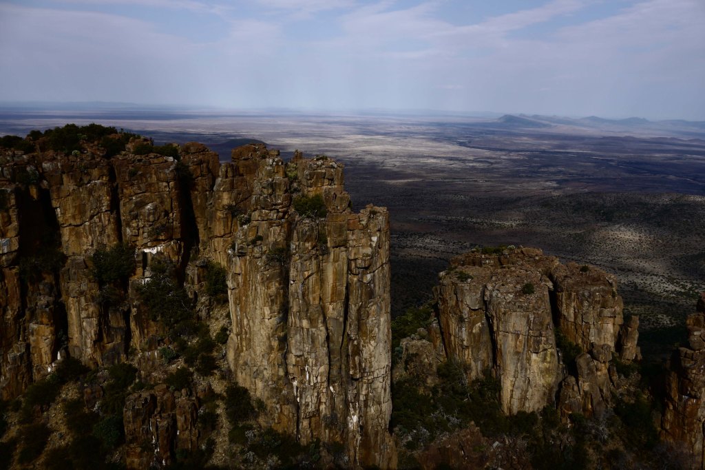
The viewpoint above the Valley of Desolation offers a stunning view over a flat plan landscape in which high piled dolerite columns reach into the air. In a period of over 100 million years volcanoes, the drifting apart of the pre-historic-continent Gondwanaland, rain and wind have created this surreal scene.
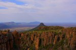
To experience the great view in its fullest I do recommend not only to walk the few hundred meters towards the viewpoint but afterwards to take a short hike along the 1.5 kilometres long Crag Lizard Trail. Good shoes and long trousers are necessary because the path is rocky and small, thorn bushes growing at its borders. Sometimes the path is not that easy to find, since game trails are crossing that can easily be mistaken for the hiking path. Naturally there are signs marking the trail, but they are not always there when you need them and some are hard to read due to weathering. The Crag Lizard Trail is a round path starting and ending at the parking lot. The highest point of the path is also the reward for hikers: Whoever gets there has a stunning view over the whole Camdeboo National Park and the karoo – in every direction – something that cannot be said about any other point on the road reachable by car.
More information: http://sanparks.org/parks/camdeboo/
—-
Einer der geographischen Höhepunkte am Eastern Cape ist das Valley of Desolation, das heute im Camdeboo Nationalpark liegt. In weniger als zehn Minuten ist der Eingang von Graaff-Reinet aus zu erreichen. Danach folgt eine teils asphaltierte Straße, teils staubige Piste bis hoch in die Berge. Der letzte knappe Kilometer bis zum Klippenrand ist allerdings ein Fußweg.
Dort angekommen eröffnet sich der Blick über das gesamte Tal. Steinerne Riesen erheben sich vor der Weite der Halbwüste, roter Stein, dazwischen einzelne Büsche und Geröll. Entstanden in einem 100 Millionen Jahre langen Prozess, lag ihr geographischer Ursprung auf dem Urkontinent Gondwanaland, aus dem, als er zerbrach, Afrika, Südamerika, Australien, die Antarktis und Indien hervor gingen. Durch Vulkane, Wind und Wasser bildete sich die heutige Form der Valley of Desolation. Schon im 19. Jahrhundert erhielten die Steinformationen den Status als Nationalmonument, die erste befestigte Straße zum Aussichtspunkt ließ die Regierung 1930 errichten.
Wer allerdings die Aussicht richtig genießen will und halbwegs schwindelfrei ist, der sollte den 1,5 Kilometer langen Crag Lizard Trail entlang laufen. Lange Hose und zumindest Turnschuhe empfehlen sich, der Pfad ist steinig, holprig und an den Rändern mit dichtem Dornengestrüpp bewachsen. Auch ist der Weg trotz Beschilderung nicht immer einfach zu finden, da Wildpfade kreuzen. Am höchsten Punkt des Rundpfades eröffnet sich dann aber ein einmaliger Blick über den gesamten Camdeboo Nationalpark – eine Aussicht, die kein einziger anderer Punkt bietet, den Besucher mit dem Auto erreichen können.
Weiter Infos: http://sanparks.org/parks/camdeboo/

Leave a comment